Moisture Updates - August 9, 2023

Synopsis
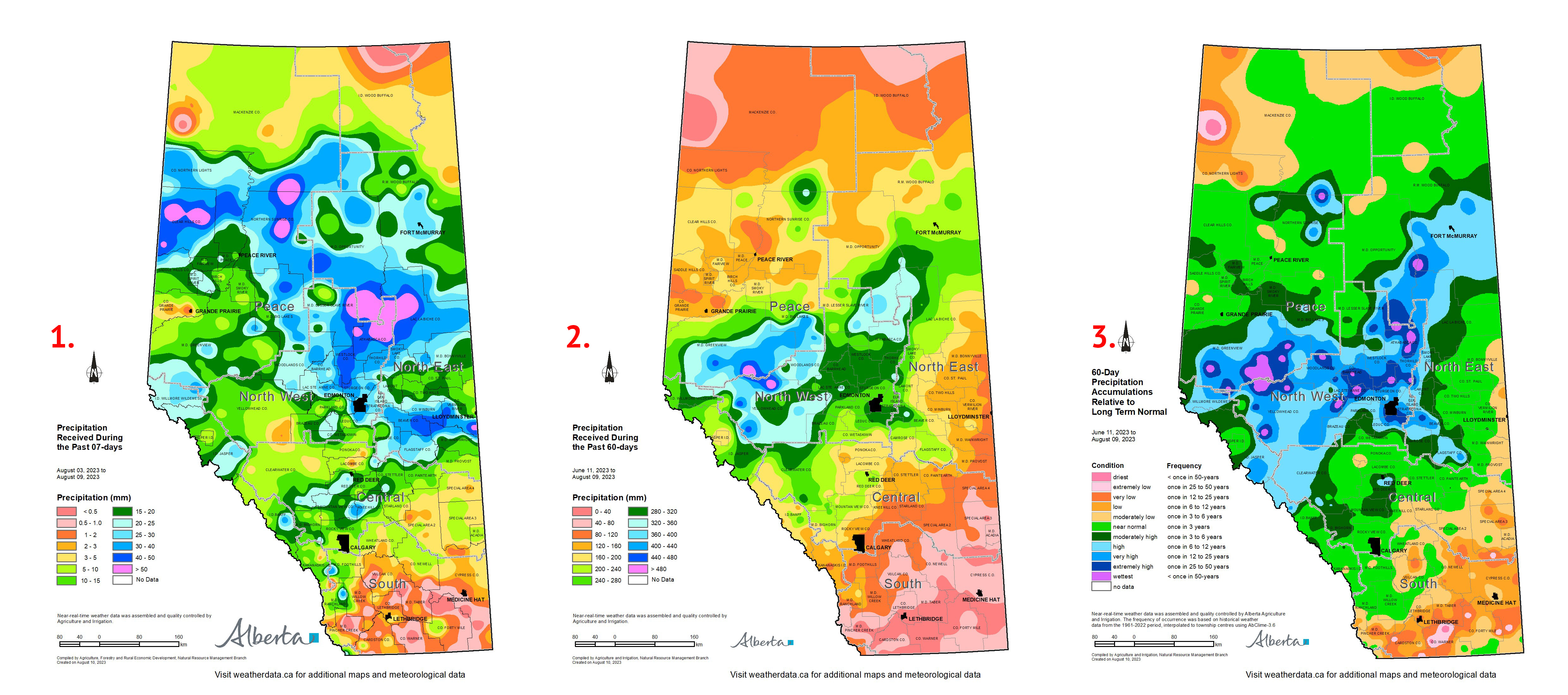
Map 1: Over the past 7-days a series of wide spread and reoccurring thunderstorms have brought rain to many parts of the province, including dry areas of the Peace Region and dry lands through parts of the North East (Map 1). The heaviest rains were concentrated in the northern parts of the North West most of North East Region, and throughout the Central Peace Region where, rainfall totals ranged from 20 to 50 mm, or more. Similarly a large area in and around Red Deer Received more than 20 mm. In sharp contrast, most of the southern-half of the Southern Region and through many parts of the Special Areas, rain is still desperately needed with 7-day accumulations ranging from 0 to 5 mm. For these areas conditions have been dry for several months now, and most significantly, through the two most important months of the year, June and July.
Precipitation Patterns over the Past 60-days, as of August 9, 2023
Maps 2, 3 & 4: Over the past 60-days, most of the Southern Region has received less than 80 mm of rain, with a large areas across the southern third, of the region that has received less than 40mm (Map 2). Across the Agricultural areas, no fewer than 9 weather stations have received less than 25 mm over this time frame with the least amount recorded at the Wrentham AGDM station (12.9 mm), followed closely by Milk River Ridge (14.2 mm), Delbonita (15.2 mm), Pincher Creek Climate (15.7 mm) and Lethbridge CDA (20.4 mm). This is well below the 1991-2020 average accumulations that range from 117mm at Wrentham to 130 mm at Pincher Creek.
In sharp contrast, 12 stations in the Forest Protection Areas have received over 400 mm with the greatest amount (511 mm) recorded at the Berland Auto station about 70 Km NNE of Hinton. Some Ag. lands in the North West and southern Peace Regions are likely impacted by excess moisture with nearly 350 mm falling at the Pleasant View AGCM station (north of Athabasca), which is 180 mm above the average for this time frame. Nearly 160 mm of this rain has fallen over the past three weeks. Much of the recent rains have been due to intense thunderstorm activity and its very likely many localized areas have received significantly more than what is depicted on these maps.
Across several pockets in the North West Region and parts of the Southern Peace Region, the past 60-days has been very wet, approaching once in 50-year highs (Map 3). In sharp contrast, many parts of the south are trending to at least once in 6 to 12 year lows accompanied by above average temperatures and many locales are in the once in 25 to 50 year low category. Dry areas also exist across the northern Peace Region. Note Map 3 understates the dry conditions present across parts of the western Peace Region as rains only returned recently (third week in July), following a long dry spell that began in mid-July of 2022 with only a brief respite during a moderately wet May long weekend.
Perspective
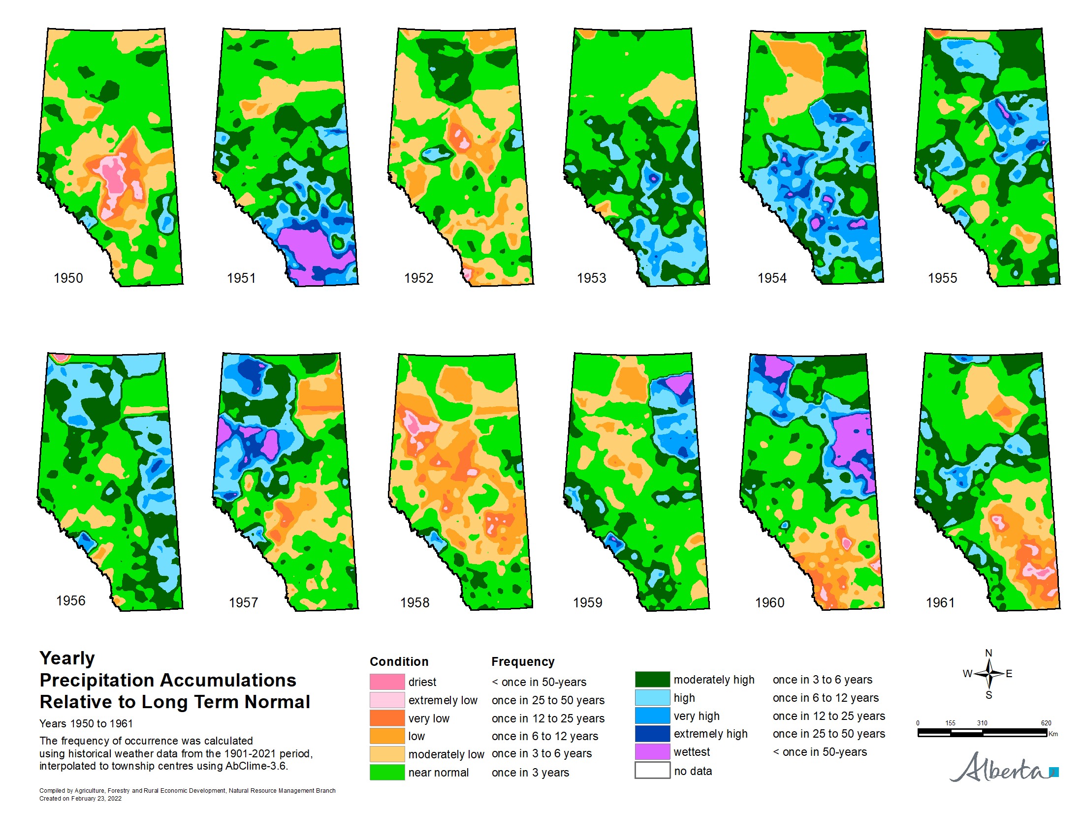
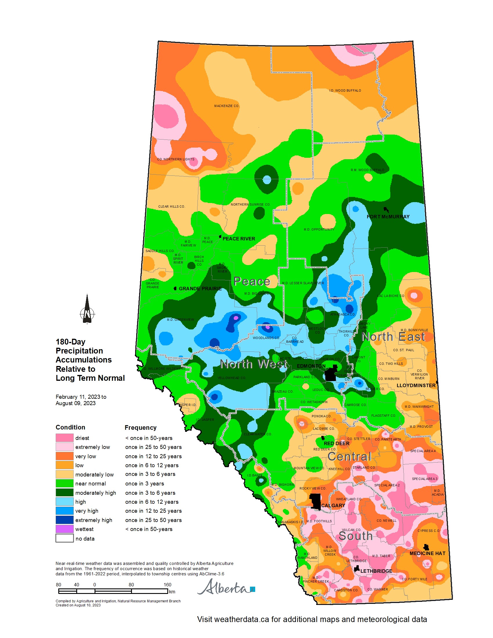
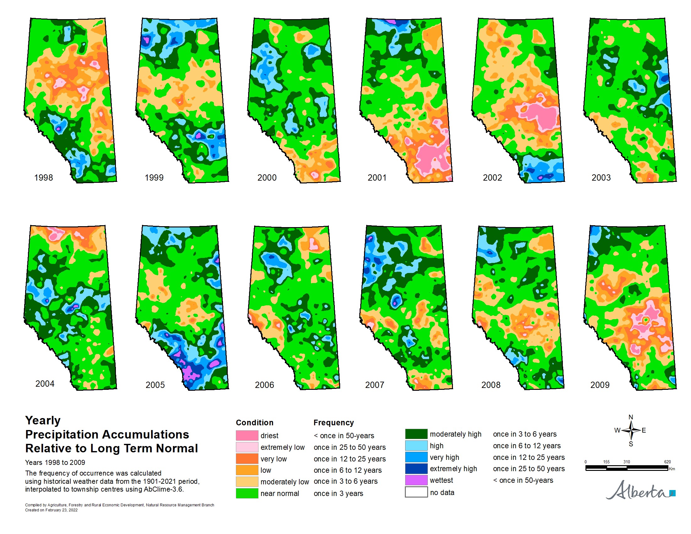
As with many other years in the past, there is a stark and dramatic contrast in current moisture conditions across the province. For those acquainted with the full meteorological record, this is not unusual. Map 4 depicts yearly precipitation accumulations for 12 years, 1950 to 1961, relative to the 1901 to 2021 long term average. Comparatively a similar situation has occurred in 2023 (Map 5) relative to 1961 and perhaps even 1960. More recently and likely fresh in some memories, is 2002, which is opposite to 2023 (Map 6). That year, the south was very wet, following the 2001 drought, yet much of the North West, and North East Regions suffered from severe lack of moisture, with only a few dozen kilometers separating the wet areas from the dry areas. Looking back beyond living memory Map 7 there were several exceptionally dry years during the early part of the century (1914 to 1925). Note that there were far fewer meteorological stations operating over this period, so direct comparisons must be made with caution.
Mother Nature is unpredictable and 2023 is still far from over. Wet and dry spells often start and end abruptly and the shift can be sudden with sharp contrasts occurring over relatively short distances. Hopefully this fall, the drying trend across the dry south reverses and excess rains abate ahead of harvest across the soggy parts of the North West, North East and southern Peace Regions.
It’s impossible to reliably predict what the weather will be like over the next several months. Planning for wild swings in weather patterns along with a genuine understanding of past weather events contained in the meteorological record, remains a valuable tool for planning for and managing risk associated with Alberta’s often extreme and unreliable weather patterns.
Contact Us
Saddle Hills
Junction of Hwy 49 & Secondary Hwy 725
RR1, Spirit River AB
T0H 3G0
T. 780-864-3760
Fax 780-864-3904
Toll-free 1-888-864-3760
frontdesk@saddlehills.ab.ca
Sign up to our Newsletter
Stay up to date on the Saddle Hills activities, events, programs and operations by subscribing to our eNewsletters.